Editor's Picks
Plant Focus
 |
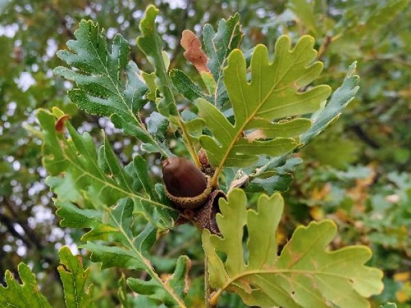
| Quercus ithaburensis in Nordia on the Sharon Plain in central Israel, girth: 322 cm © Ezra Barnea |
In May 2017, I went to visit Edie & Guy Sternberg in Starhill Forest Arboretum. Guy convinced me to submit a proposal to present in the upcoming 9th IOS Conference in Davis, California. So I wrote a proposal and named it "Reforestation of Mount Tavor Oak in the Low Land of Israel".
Later that year, I was referred by a close friend to a question on Facebook submitted by a tourist guide who was looking for large Mount Tavor oak trees (Quercus ithaburensis) in my neighborhood. It took me a few minutes to put together a list with details of 10 monumental trees out of my collection of over 250. As I was sending the list out, it occurred to me that I should gather and plot my information on a map. The next morning, I decided to develop a map which would allow the registration of all the oak trees in Israel. I selected a geographic information system (GIS) platform and by pure luck got Noam Etzioni, who I didn’t know at the time, to develop an application for me, free of charge. This map is a suite combining three elements: an online presentation map, an online survey app that allows the registration of an oak tree by anyone using a mobile phone, and a dashboard which shows statistical analysis of the data gathered on the map.
 |
| Tree card for the Nordia Mount Tabor oak, in original Hewbrew version (click on images to enlarge) |
The aim of the Israel Oak Registry is to identify, measure, and register the location of all oak trees in Israel, wild or planted, including introduced species, that have a diameter of 50 cm or more. The project is intended to serve the tourist, hiker, research person, nature and tree lover, and anyone who has a passion for oak trees. It is implemented using ArcGIS suite by Esri. The registry is online and can be accessed here: https://goo.gl/ARFFsr. The site is mostly in Hebrew, but you can use a browser’s translate function to view it in English or the language of your choice.
Every tree has a card with different details which include:
|
|
The tree card has about 20 different fields that can be used for a complete description. The map includes a layer that allows the editor to outline and describe a specific area of land, such as a garden, park, hill, etc.
The system relies on the participation of nature lovers to register trees, in order to cover the entire country. As of August 2018, over 1,050 trees have been registered, about half of which have a complete detail card. Aside from native species (Q. ithaburensis, Q. calliprinos[1], Q. boissieri[2], Q. cerris, Q. look), three introduced species are included in the registry: Q. suber, Q. ilex, and Q. robur.
 |
| A screenshot of the data analysis view |
In March this year, I received the invitation to participate in the IOS Conference as a presenter. So I decided that before submitting my presentation I would set out to register every oak with a diameter of 50 cm or more in the low land, or Sharon plain. I tried to get a TV reporter to join me and film this project. This reporter could not join me, but he suggested I keep him posted on my progress.
At the beginning of May this year, I decided to focus on the area of Pardes Hana, a region known as Karkur forest, which was covered with a forest of Mount Tabor oaks until the end of the 19th century and still had some trees left behind. After four weeks of field work, I realized that this area still contains hundreds of trees, 20% of which have a main trunk exceeding 85 cm in diameter. I was stunned and my excitement has not faded since then. Even in my wildest dreams I had not imagined the presence of such a large group of big, magnificent, impressive, noble oak trees.
This discovery generated many initiatives for preservation, publicity, education, and much more. The TV reporter I had contacted, who was still unable to support this activity, referred me to a Channel 10 program, London and Kirshenbaum. The people there invited me immediately, the day after they heard about my project. You can view the interview, with English subtitles, here: http://www.goo.gl/NP3N6c
The development of this map is in its early stages. Next steps include a graphic field guide for the oaks of the region, a user manual for measuring and registering trees, and improvement of both graphic and function displays. This suite is open to all, developed nonprofit system with the aim of sharing knowledge for the benefit of society.


